Quick facts
Outline of Okinawa
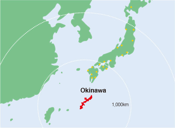
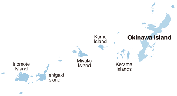
Okinawa Prefecture consists of 160 islands stretching 400 kilometers north to south and 1,000 kilometers east to west between the Pacific Ocean and the East China Sea, of which 49 are inhabited. The chain is known as the Ryukyu Islands.
Capital: Naha City
Population: 1,461,140 (as of Apr. 1, 2025)
Area: 2,275.91 square kilometers
Number of inhabited islands: 49
Number of foreign tourists: 2,120,000 (2024)
Number of mainland Japan tourists: 7,530,000 (2024)
From A to Z on Okinawa
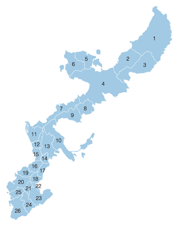
- 1. Kunigami Village
- 2. Ogimi Village
- 3. Higashi Village
- 4. Nago City
- 5. Nakijin Village
- 6. Motobu Town
- 7. Onna Village
- 8. Ginoza Village
- 9. Kin Town
- 10. Uruma City
- 11. Yomitan Village
- 12. Kadena Town
- 13. Okinawa City
- 14. Kitanakagusuku Village
- 15. Chatan Town
- 16. Ginowan City
- 17. Nakagusuku Village
- 18. Nishihara Town
- 19. Urasoe City
- 20. Naha City
- 21. Haebaru Town
- 22. Yonabaru Town
- 23. Nanjo City
- 24. Yaese Town
- 25. Tomigusuku City
- 26. Itoman City
Climate
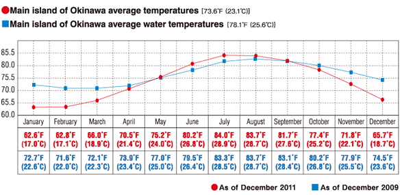
Okinawa belongs to a subtropical climatic region and has an annual average temperature of 23.3 degrees Celsius. A seasonal wind blows from the south in summer and from the north in winter. About 10-15 typhoons hit Okinawa each year during the summer and autumn months. To be prepared for a typhoon, you should regularly check typhoon warnings in newspapers and on TV and radio. When a typhoon warning is announced, bus service stops, and school and public offices are closed.
Addendum:
Miyako Islands: average temperature 64.4˚F (18.0˚C); average water temperature 78.8˚F (26.0˚C)
Ishigaki Island: average temperature 65.5˚F (18.6˚C); average water temperature 79.0˚F (26.1˚C)
*Conversion ˚F=˚C×1.8+32, ˚C=(˚F-32)÷1.8


